St Lewis

Back to Newfoundland Map List Labrador Photos Page 1 of 1
st lewis 1.jpg (39761 bytes) St Lewis appears as Fox Harbour on some charts.

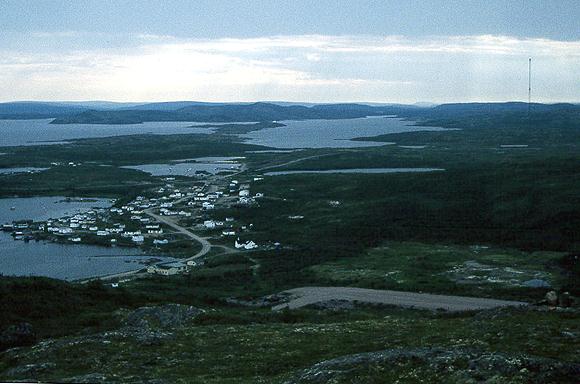
The grey stripe in the foreground is the gravel airfield. There is a 12 month, daily air service to several communities on the Labrador coast as far north as Nain.
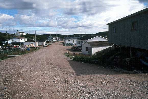
Main Street St Lewis. The road serves just the local community

In 1999 it was announced that St Lewis will be joined to the new coastal road being built from Red Bay to Cartwright. Everyone I met was very excited at the news.

st lewis 2.jpg (40005 bytes)
st lewis 3.jpg (39491 bytes) Most year round communities have a health clinic staffed by nurses. A doctor and dentist visit every few weeks. Urgent cases are flown out on  Medivac flight.
I visited St Lewis in 1998, 1999 and again in 2000 and made good friends with the Poole family.

Here I am returning their kind hospitality by taking them out for a sail. Most Labradorians have never been on board a sail boat.

st lewis 4.jpg (39606 bytes)
Back to Newfoundland Map List Labrador Photos Page 1 of 1